

I-69 / 465 Land
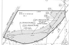
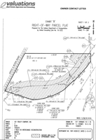
Land | 5.65 acres
Marketing description
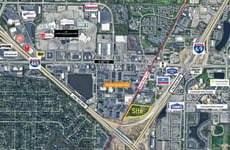
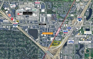
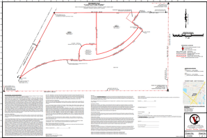
5.65 acres of prime, C-5, commercial ground located at the intersection of I 69 & 465 on Indianapolis' northeast side. All utilities are available at the site. The property is highly visible from both I69 and 465. Average daily traffic counts are approximately 142,604 on I 69 & 146,745 on 465. The property is an ideal site for health care use utilizing the same 82nd Street exit as Community Hospital North, Community Heart and Vascular Hospital, and Community Rehabilitation Hospital. Zoning also permits outdoor uses, such as, outdoor displays and entertainment.
The Nickle Plate Trail that runs adjacent to entire western property line is a 14’ wide asphalt trail designed for walking, biking, and running. The Nickle Plate Trail connects with the Monon Trail and the Midland Trace Trail, which together create a 41-mile loop that connects the Indianapolis, Fishers, Noblesville, Westfield, and Carmel communities. The trail promotes recreation, health, community, regional connectivity and spurs economic growth.
Listing Contacts
Valuation Calculator
Valuation Metrics
Broker Selected Comps View More Comps
Property History
Tax History
Similar Properties
Additional Information
Is there information that looks off?