
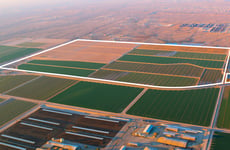
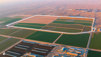
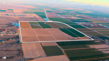
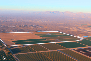
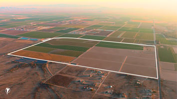
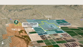
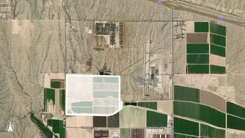
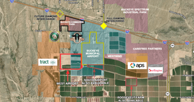

West Airport - 474 ± Acres
West Airport | 474± Acres
Marketing description
This investment property is located just west of the Buckeye Municipal Airport. The current zoning is Maricopa County RU-43. Per the City of Buckeye General Plan, the property boundary lies within the Buckeye Municipal Airport Activity Center, which is expected to be a hub for future development.
This property has easy access off of Interstate 10 with paved frontage along Johnson Road. There is a planned interchange at Johnson Road that will provide direct access to Interstate 10. The property is located in the Arizona Opportunity Zone, which is an ideal location for an industrial site and an excellent investment opportunity. This property has good water adequacy and includes 8 on-site wells as well as grandfathered groundwater irrigation rights.
ZONING: Maricopa County RU-43, Buckeye General Plan: Activity Center & Employment
MARICOPA COUNTY APNs: 504-30-017A , 504-30-030, 504-30-029 , 504-30-013 , 504-30-014, 504-30-011 , 504-30-012 , 504-30-010 , 504-30-015
WATER: Located within the Phoenix AMA, this property includes 8 on-site wells and Grandfathered Groundwater Irrigation Rights.
Well Registration #’s: 55-620369, 55-604630, 55-604629, 55-087695, 55-604639, 55-622917, 55-622918, 55-6229419
Irrigation Right #’s: 58-102357.0001, 58-115861.0003
LOCATION & ACCESS: Located south of Lower Buckeye Rd, east of Johnson Rd, and north of the Roosevelt Canal, just 1.75 miles south of Interstate 10. Future Johnson Rd Interchange. This property has easy access off Interstate 10 with paved frontage along Johnson Road.
Listing Contacts
Valuation Calculator
Valuation Metrics
Broker Selected Comps View More Comps
Property History
Similar Properties
Additional Information
Is there information that looks off?