
160-acre development opportunity
160-acre development opportunity
Marketing description
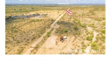
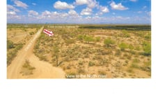
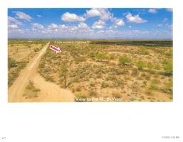
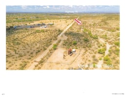
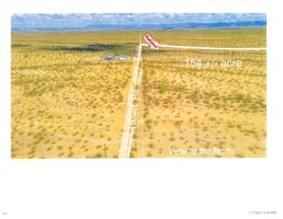
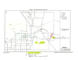
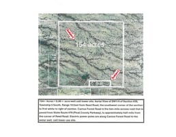
The Property is located approximately 10.5+-miles southeast of Florence, Pinal County, Arizona, plus : Turn additional 2.5+- miles East on Cactus Forest Road. Access is paved to within approx. a half mile, of the frontage of SW corner of Subject Quarter Section Property, starts just east of NEC of North Reed Rd. & Cactus Forest Rd. Major road and electrification/data storage projects announced near Florence, AZ, plan for the expansion of the new 505 Freeway connecting East Valley with Eloy, AZ at Interstate #10. Pinal County and the State of Arizona are expecting to build a 55-mile alternative to Interstate #10 in two phases, for East Valley residents with projected growth of 800,000 new residents by 2040.
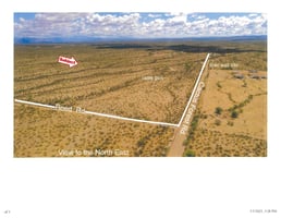
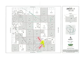
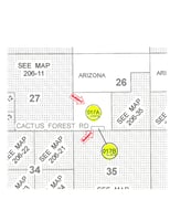
The subject properties are both located in the SW 14 section of Section #26. The topography is lightly vegetated with desert shrubs, grasses, and a few saguaros. The property is presently used as a small fenced, cattle feeding operation, shown in the corral area of photos. The 6.00-acre property is fenced around well-site, and the subject Cactus Forest Road frontage is partially fenced. No permanent dwellings are currently on the subject property. The Sellers of both parcels are related members of Armstrong Ranch family. The 2025 R.E. Taxes are $24/year. ADOT has announced close by access to AZ SR#505 alternative to I-#10 (Apache Junction to Eloy - 7/21/25).
154.00+-/Acres, located in SW1/4 of Section #26, Twn 5S, Rng 10E, Pinal County Tax Code #206- 01-017A. An additional 6.00+- Acre property in the SW1/4 Section is available, which has been designated a Well-Cell Tower site, has Pinal County Tax Code #206-01-017B.
Investment highlights
The entire quarter section is zoned General Rural (GR), that could be planned for minimum of one and quarter acre homesites, that are located on minimum, 160- acre quarter section of land.
Electric power poles run approximately a quarter mile or more along the south side of Cactus Forest Road frontage. Power poles are also located on the west side of Reed Road alignment and are not on the subject property, nor is the present Reed Road alignment easement on the subject property. The well water is used to port water over to the cattle feeding operation, and this water use will cease when both properties are sold together. Tonto Basin Water Company, Inc. is the water utility provider for the area and is now seeking to expand their water service area.
$ 1,250,000.00 for the 154.00+- Acre Parcel, and,
$ 150,000.00 for 6.00+- Ac. intended for Water Well & or Cell Tower Uses (One well, 2 tanks).
Cash. Submit all offers for consideration. Seller is selling property in its "AS-IS" condition. Each parcel must be purchased by separate contract.
Listing Contacts
Valuation Calculator
Valuation Metrics
Broker Selected Comps View More Comps
Property History
Similar Properties
Is there information that looks off?