

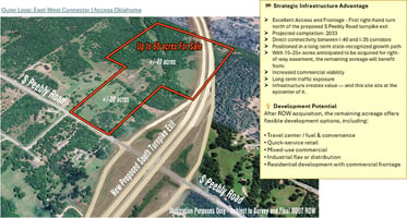


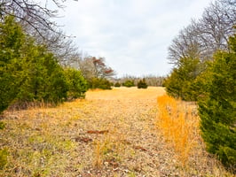


59 Acres - S Peebly Road at Interchange
Proposed Interchange - Raw Land | 59 acres
Marketing description
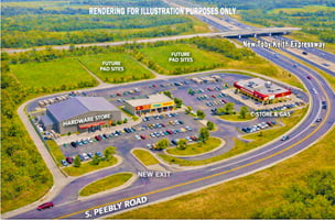
TURNPIKE FRONTAGE FUTURE: 59± Acres Toby Keith Expressway | Access Oklahoma
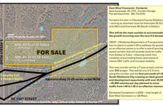
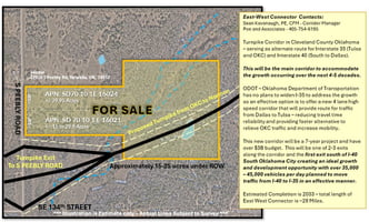
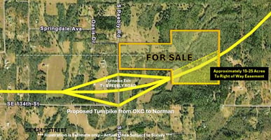
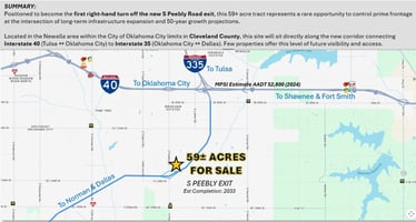
South Peebly will be the first exit South of I-40 Interchange in OKC. Positioned to become the first right-hand turn off the new S Peebly Road exit, this 59± acre tract represents a rare opportunity to control prime frontage at the intersection of long-term infrastructure expansion and 50-year growth projections.
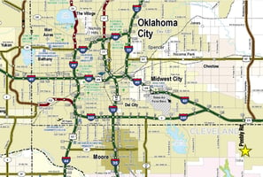
Located in the Newalla area within the City of Oklahoma City limits in Cleveland County, this site will sit directly along the new corridor connecting Interstate 40 (Tulsa ↔ Oklahoma City) to Interstate 35 (Oklahoma City ↔ Dallas). Few properties offer this level of future visibility and access.
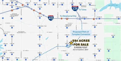
Positioned to become the first property off the new interchange along Interstate 335 connecting Interstate 40 and Interstate 35, this 59± acre offering presents a rare, early-mover advantage in the growth corridor between Oklahoma City and Norman. This will be known as the Toby Keith Expressway - Toby Keith Expressway | Access Oklahoma
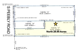
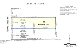
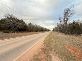
Comprised of two raw land tracts totaling approximately 59 acres, the property features over 660 feet of frontage on S Peebly Road, providing outstanding visibility, access flexibility, and development versatility. Located within Oklahoma City limits in Cleveland County, this site sits squarely in the path of expansion in Southeast OKC—strategically positioned between Norman and Shawnee.
The owner is willing to divide upon accepted offer and entitlement, and private utilities are permitted in this area of Cleveland County. Early positioning along major transportation infrastructure projects consistently drives long-term value. Secure frontage, scale, and future access in one of the metro’s most promising emerging corridors.
For entitlement strategy, zoning analysis, or phased development concepts, additional information is available upon request. Any reference to a proposed turnpike exit, interchange, or roadway improvement is based on publicly available planning information. Construction timelines, funding, final design, and access configuration are subject to change, modification, delay, or cancellation by the applicable governmental authority. Illustrations are for informational purposes only and actual lines are subject to final ROW and Survey.
Listing Contacts
Valuation Calculator
Valuation Metrics
Broker Selected Comps View More Comps
Property History
Similar Properties
Additional Information
Is there information that looks off?