


Brinkmeyer Acres
Incredible Opportunity! 247 Acres in Taylor, TX!
Marketing description
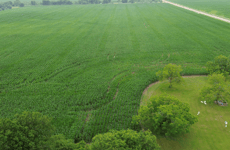
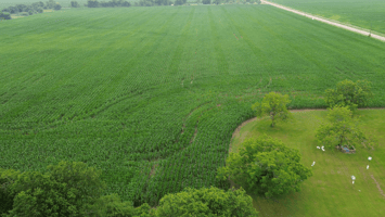
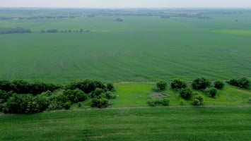
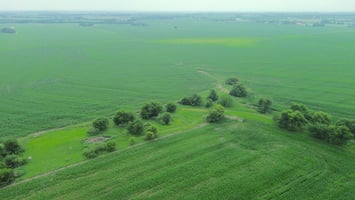
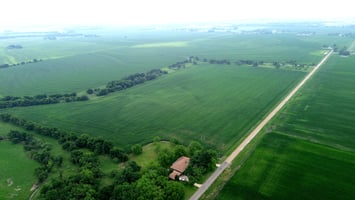
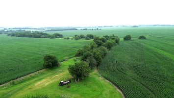
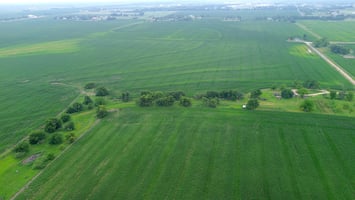
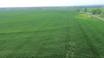
247 acres of agricultural land for sale in Taylor, Texas. One of the fastest-growing cities in Williamson County and the entire Austin metro. Located at 3501 CR 409, Taylor, TX 76574, this large acreage tract is currently ag-exempt and sits directly in the path of Central Texas's most significant economic expansion in decades.
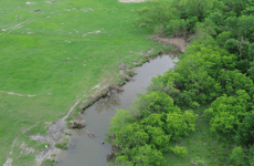
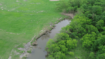
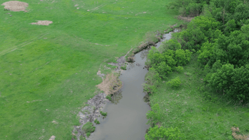
Turkey Creek runs through the property, offering natural drainage, green belt potential, and premium creek-front lot opportunities ideal for a master-planned residential subdivision or residential development. The tract backs directly to the new Chandler Road Extension. Williamson County's planned east-west highway connector linking SH 95 to FM 619, with a direct connector to US 79 providing exceptional long-term access and frontage value as Taylor's freeway loop network is built out.
Located minutes from the Samsung Austin Semiconductor Taylor campus, a $17 billion semiconductor manufacturing facility and one of the largest foreign direct investments in U.S. history and this property benefits from unprecedented demand for new housing driven by thousands of incoming high-tech jobs. With new subdivisions underway throughout Taylor, developer demand for large raw land tracts near the Samsung plant continues to accelerate. Approximately 30 miles from downtown Austin. Within Taylor ISD. Williamson County, Texas. Ag exemption in place — favorable tax basis while entitling. Ideal for residential subdivision development, master-planned community, or long-term land investment near Austin. Survey available upon request. Buyer to verify all utilities, zoning, and development feasibility with City of Taylor and Williamson County.
Investment highlights
I. GENERAL SITE INFORMATION
Gross Acreage: 246.19 Acres
Site Address:
o County Road 409, Williamson CAD No. R355879 (41.39 Acres)
o 1900 Turner Rd, Williamson CAD No. R019582 (41.52 Acres)
o County Road 409, Williamson CAD No. R355880 (38.96 Acres)
o 3451 County Road 409, Williamson CAD No. R019581 (9.67 Acre)
o 3501 County Road 409, Williamson CAD No. R019491 (1.2 Acres)
o County Road 409, Williamson CAD No. R019490 (0.91 Acres)
o 3451 County Road 409, Williamson CAD No. R019496 (112.54 Acres)
Current Land Use:
o Rural, unimproved land intended for development
Zip Code: 76574
o Taylor ISD
Governing Jurisdiction: City of Taylor, Williamson County
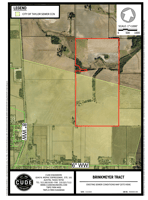
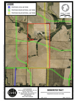
II. INTRODUCTION
The subject property is located at 3501 County Road 409 Taylor, TX, and consists of approximately
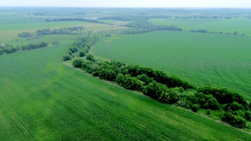
246 acres of undeveloped land. The tract is the summation of multiple large tracts between CR 409
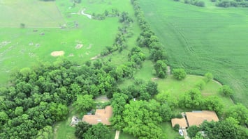
and CR 619 for the purpose of the sale. Surrounding development includes agricultural tracts,
residential communities, and commercial sites to the west in central Taylor. The site is divided by
the boundary of the City of Taylor and it’s ETJ. The tract is subject to the development guidelines
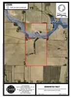
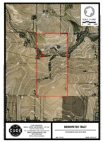
of the City of Taylor, as well as Williamson County. See Exhibit 1, Aerial Map, and Exhibit 2, City
Limits Map.
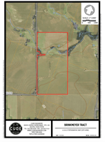
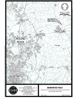
III. LOCATION
The subject site is located just east of central Taylor, and approximately 3.5 miles from the
intersection of TX 95 & US 79. The site is also located approximately 7 miles from the Samsung
Semiconductor Taylor Plant. Additionally, the property is approximately 40 miles from Austin-
Bergstrom International Airport and roughly 38 miles from downtown Austin. See Exhibit 3,
Location Map.
IV. ZONING
Most of the subject property lies within Taylor City Limits and is zoned as rural. The remainder of
the property lies outside the city limits and within the City of Taylor ETJ; therefore, no municipal
zoning applies to this portion of the site.
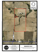
V. ACCESS AND TRANSPORTATION PLANS
The tract provides approximately 4500 feet of frontage along Turner Rd – the western boundary of
the tract. Turner Rd Ln is a 2-lane undivided roadway which may require improvements to serve the needs of the tract. Future transportation plans also include a proposed Arterial 100 ft. Right-of-
Way dividing the property from east to west, as well as a proposed 120’ Right-of-Way Major Arterial
dividing the property from north to south. See Exhibit 4, Transportation Map.
VI. TOPOGRAPHY
The property has several high points of +/- 604 feet above Mean Sea Level (MSL) and falls northwest
with slopes ranging approximately from 1-3%. See Exhibit 5, Topographic Map.
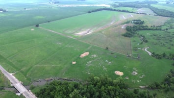
VII. FLOODPLAIN
The subject property contains approximately 20 acres of FEMA 100-year regulated floodplain as
identified on FEMA FIRM Panels No. 48491C0532F & No. 48491C0534F. See Exhibit 6, FEMA
Floodplain Map.
VIII. ENVIRONMENTAL
A review of publicly available mapping resources, including the USGS National Map Viewer,
indicates the presence of an existing pond on the subject property. The feature is depicted with a
mapped blue line, suggesting a potential surface water connection or drainage feature. At this time,
the regulatory status of the pond and any associated wetlands or drainage features has not been
confirmed. The presence of mapped hydrographic features does not, by itself, establish federal or
state jurisdiction.
A formal Waters of the U.S. (WOTUS) / Jurisdictional Waters Determination by a qualified
environmental consultant, and verification by the U.S. Army Corps of Engineers (USACE) and/or
applicable state regulatory agency, will be required to determine whether the pond and any
adjacent wetlands or conveyances are subject to federal and/or state jurisdiction. If the feature is
determined to be jurisdictional, impacts associated with site development may require permitting
under Section 404 of the Clean Water Act and applicable state regulations. Such permitting could
affect site layout, grading limits, stormwater design, and project schedule. Buffer requirements and
mitigation obligations may also apply. It is recommended that jurisdictional delineation and
agency confirmation be completed early in the design process to assess potential development
constraints and permitting requirements. See Exhibit 7, U.S.G.S. Topographic Map.
IX. STORM DRAINAGE AND DETENTION
With the development of this project, the applicant will be required to intercept, convey, and detain
the stormwater to mitigate any increases in impervious cover created, unless a peak-on-peak
stormwater analysis can be proved up to avoid the detention requirement.
Stormwater runoff from the subject property drains north and ultimately into Turkey Creek. All
structures are to be designed to safely convey the 25-year and 100-year flood event. Culvert
headwater elevations must not exceed the minimum road surface elevation. Open channels must
be designed in accordance with Williamson County criteria. All headwalls, wing walls, ditch checks,
inlets, and other drainage structures must be designed and constructed to Williamson County and
standards within dedicated easements. The current data on the soil of the area has the soil type D
– Burleson Clay & type C – Krum Silty Clay complex.
X. WATER
The subject property is within the City of Taylor Certificate of Convenience and Necessity (CCN) for
water service. The City of Taylor has an existing 12-inch water line connecting the city’s
infrastructure to the southmost corner of the property. Prior to connecting to City of Taylor water
lines, an application, and fee for an engineering feasibility study will be required to determine if the
system has the capacity and what infrastructure upgrades may be required to serve the site. If there
is existing capacity, then the owner or developer will be required to sign a contract with the City of
Taylor and provide the necessary utility easement dedication. See Exhibit 8, Existing Water
Conditions Map.
XI. WASTEWATER
A large portion of the subject property is located within the City of Taylor Sewer Certificate of
Convenience and Necessity (CCN) service area, with the remaining portion not belonging to any
CCN. The City of Taylor has existing sewer lines to the south and west of the property that may be
able to serve the property. See Exhibit 9, Existing Sewer Conditions Map.
XII. DRY UTILITIES
The subject property is within the ONCOR Electric Delivery Company area for electric and Atmos
Gas service area for gas. There is an existing overhead electric line approximately a mile west of the
property. A predevelopment meeting with ONCOR and Atmos will be needed to determine the
infrastructure upgrades required to serve the tract.
Listing Contacts
Valuation Calculator
Valuation Metrics
Broker Selected Comps View More Comps
Property History
Tax History
Similar Properties
Additional Information
Is there information that looks off?