

Listed by Lockhart Real Estate
$1,200,000
Hashknife North Ranch
Details
Property Type Land
Sub Type Commercial, Farm
Price Per Acre $3,170
Acreage 346.000
Land | 346 acres
Marketing description
Hashknife North Ranch
(346+/- Acs - Edwards County)
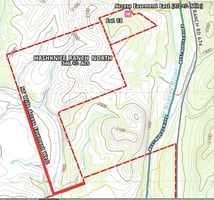
346+/- Acs (Subject to Survey)
Includes 34+/- Acs in Paula Verde West Subdivision
Insured Access Off Rr #674
Plus 50 Wide Easement Access Off Cr #551 to West Side of Property
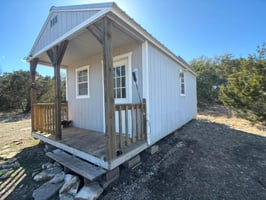
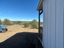
10 X 24 Camp Building
Shared Community Well on Paula Verde Tract
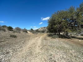
Location & Access: The Hashknife North Ranch is Located About 1/2 Mile Off Texas Hwy 674 About 19 Miles From Rocksprings in Edwards County. This Location Insures Seclusion but is Still a Convenient Distance From Town for Supplies and Cafes. A Good Quality Private Easement Insures Year-round, All-weather Access From the Highway.
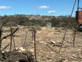
Improvements: The Camp Building is a Small but Convenient Cabin for Overnight Protection From the Elements and Storage. It is Located a Short Distance From the Access Road Along Which Electrical Power Could Be Extended to the Property and Then a Short Distance to the Cabin.
Fencing: Fencing Around the Perimeter of the 312+/- AC Main Tract is Typical Livestock Fencing in Various Conditions. The Owners Plan to Construct a New Fence Along the East Boundary of the 312+/- Acre Main Tract.
Water: The Camp Building is Located on the the Paula Verde Subdivision Tract #13 for Convenient Access to a Community Water Well Located a Short Distance Down the Subdivision Road.
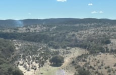
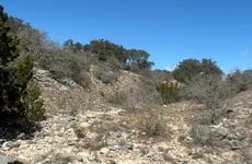
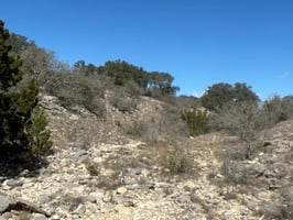
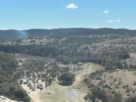
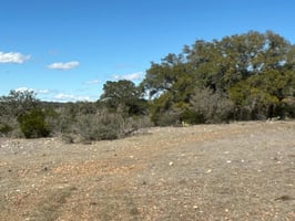
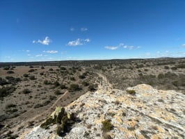
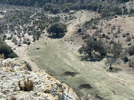
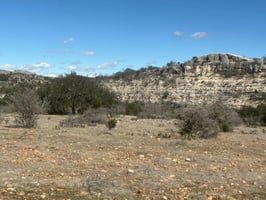
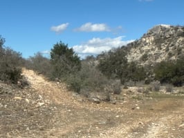
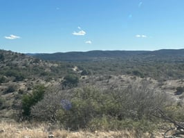
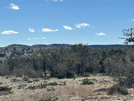
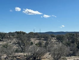
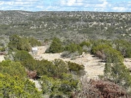
Topography: The Ranch Topography is Classic Hill Country. Two Large, Parallel, Wet Weather Creeks Run Across the Northwest Part of the Ranch, Separated by a Wide, Southwesterly Sloping Ridge. These Wet Weather Creeks Flow Into Another Huge and Scenic, Wet Weather Creek That Runs Along Half the Entire Western Boundary of the Ranch. East of the Parallel, Wet Weather Creeks, Spectacular Bluffs and High Hills Connected by a Long, Meandering Ridge Overlook the Oak Lined Creek Bottoms. Miles of Spectacular Views Are Extend in Almost Every Direction. At the Northeast Corner of the 312+/- AC Main Tract, the East Side of the High Ridge Slopes Off Into the 34+/- Acre Subdivision Tract Where the Cabin is Located. During Rainy Weather, These Wet Weather Creeks Provide Massive Amounts of Runoff and Lingering Potholes of Water for Game.
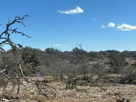
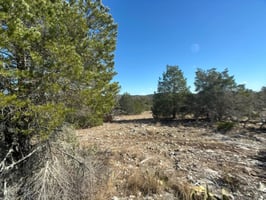
Cover: Cedar Has Been Controlled Historically, So the Remaining Vegetation is Light to Heavy but Not Overly Dense and What Remains is Mostly the More Desirable Browse and Cover for Game. The Lack of Dense Cedar Creates a Healthy Vegetation Profile So That, When It Rains, the Land Can Produce Beneficial Browse to Its True Potential. Scattered Pion Pine Trees in the Area Hint at the Ranch's Location Near the Northern Edge of the Texas Transition Zone, an Area Where the Edwards Plateau and South Texas Blend Together, Characterized by Vegetation Common to Both Regions. Some Say It Provides the Best of Both Areas.
Game: The Hashknife North Ranch is Carved Out of the North Part of the Psalm Xxiii Ranch Which Consists of Several Thousand Acres. A Feeding Program in Place for Several Years Has Maintained a Good Population of White-tail Deer. According to a Biologists Habitat Report of the Psalm Xxiii Ranch Prepared Several Years Ago (Copy Available Upon Request), Other Species Present on the Ranch Include Axis Deer, Aoudad, Mouflon Sheep, Spanish Goats, Rio Grande Turkey, Bobwhite Quail, Montezuma Quail, Feral Hogs, Raccoon, Coyote, Bobcat, and Gray Fox. A Whitetail Buck Harvested From the Psalm Xxiii Ranch Won the Edwards County Big Buck Contest in 2008.
Terms: $1,200,000.00 or $3,170.00 Per Acre. Owner Finance Considered. Minerals Negotiable.
Investment highlights
- Amenities Financing Options Mortgage Options: Owner Finance
- Land Activities: Camping; Horseback Riding; Hunting
- Game: Dove; Hog; Quail; Turkey; Whitetail Deer
- Land Type: Livestock
- Lot Description: Acreage; Horses Permitted; Oil or Minerals ;Pasture
- Miscellaneous: Fenced for Cattle; Fenced for Horses
- Present Use: Hunting/Fishing
- Property Tax Exemption: Yes
- Property Type: Farm/Ranch
- Proposed Use: Grazing; Hunting/Fishing
- Road Frontage Desc: Gravel/Rock; Insurable Access; Private; Road Easement
- Special Notes: Survey Available
- Street/Utilities: Gravel/Rock; Private Road
- Surface Rights: All
- Topography: Hilly; Rolling; Sloped; Steep; Varied
- Type of Fence: Barbed Wire; Livestock Net Wire & Barbed
Listing Contacts
Listed by Lockhart Real Estate
Valuation Calculator
Login or Sign up to see Valuation Metrics
Sign up for Crexi to see valuation metrics for this property
Loan Amount
$0.00
Annual Debt Service
$--
$--
Annual Cash Flow
$--
$--
Valuation Metrics
0
DSCR
--
Cap Rate
--
ROI
Broker Selected Comps View More Comps
Property History

Similar Properties
Is there information that looks off?
