


Marysville I-5 Interchange Development Land
Land | 98.15 acres
Marketing description
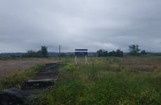
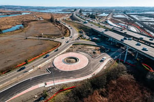
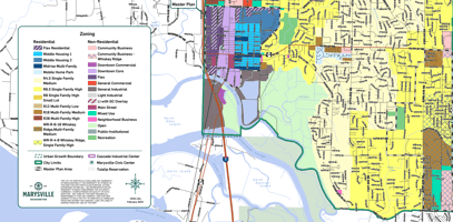
The Subject Property is Composed of Four Tax Parcels That Together Total Approximately 98 Acres. This is a Value-plus Opportunity for a Developer / Construction / Land Fill, Contractor. The Parcels May Be Sold Separately. The Majority of the Site Contains an Estuarine Wetland and Floodplain Associated With Ebey Slough. Approximately Nine (9) Acres of Upland Area is Located in the Northwest Corner of Parcel 30053300200400, Along the East Side of Northbound Sr-529. This Relatively Flat, Elevated Portion of the Site Has a Gravel Surface With Remnant Concrete Slabs From Past Uses. The Site is Located Within Shoreline Jurisdiction in the City of Marysville’s Shoreline Master Program (Smp). The Wetland is Designated as an Urban Conservancy Shoreline and the Upland Area Adjacent to the Wetland is Designated as High Intensity in the Smp. Pursuant to Chapter 3, Section C of the Smp, Non-water-oriented Commercial, Recreational, and Industrial Development Requires a 70-foot Setback From the Wetland/ordinary High Water Mark, Including a 50-foot Strip of Native Vegetation Plantings and a 20-foot Public Access Easement. The Usable Upland Area Outside of the 70-foot Shoreline Setback is Approximately Six (6) Acres.
Investment highlights
Lot Size: 2,886,286 Sf | 66.26 Ac
Parcel # 30053300300400
Lot Size: 134,600 Sf | 3.09 Ac
Parcel # 30053300300100
Lot Size: 1,099,454 Sf | 25.24 Ac
Parcel # 30053300203800
Lot Size: 155,074 Sf | 3.56 Ac
Total Sf: 4,275,414 Sf
Total Ac: 98.15 Ac
Usable Sf: 261,360 Sf
Usable Ac: 6 Ac
Land Area ±98.15 Acres | 4,275,414 Sf
Price Per Lot Sf $0.70 / Lot Sf
Usable Land Area 6 Acres | 261,360 Sf
Price Per Usable Land Area $11.47/ Usable Sf
Listing Contacts
Valuation Calculator
Valuation Metrics
Broker Selected Comps View More Comps
Property History
Similar Properties
Additional Information
Is there information that looks off?